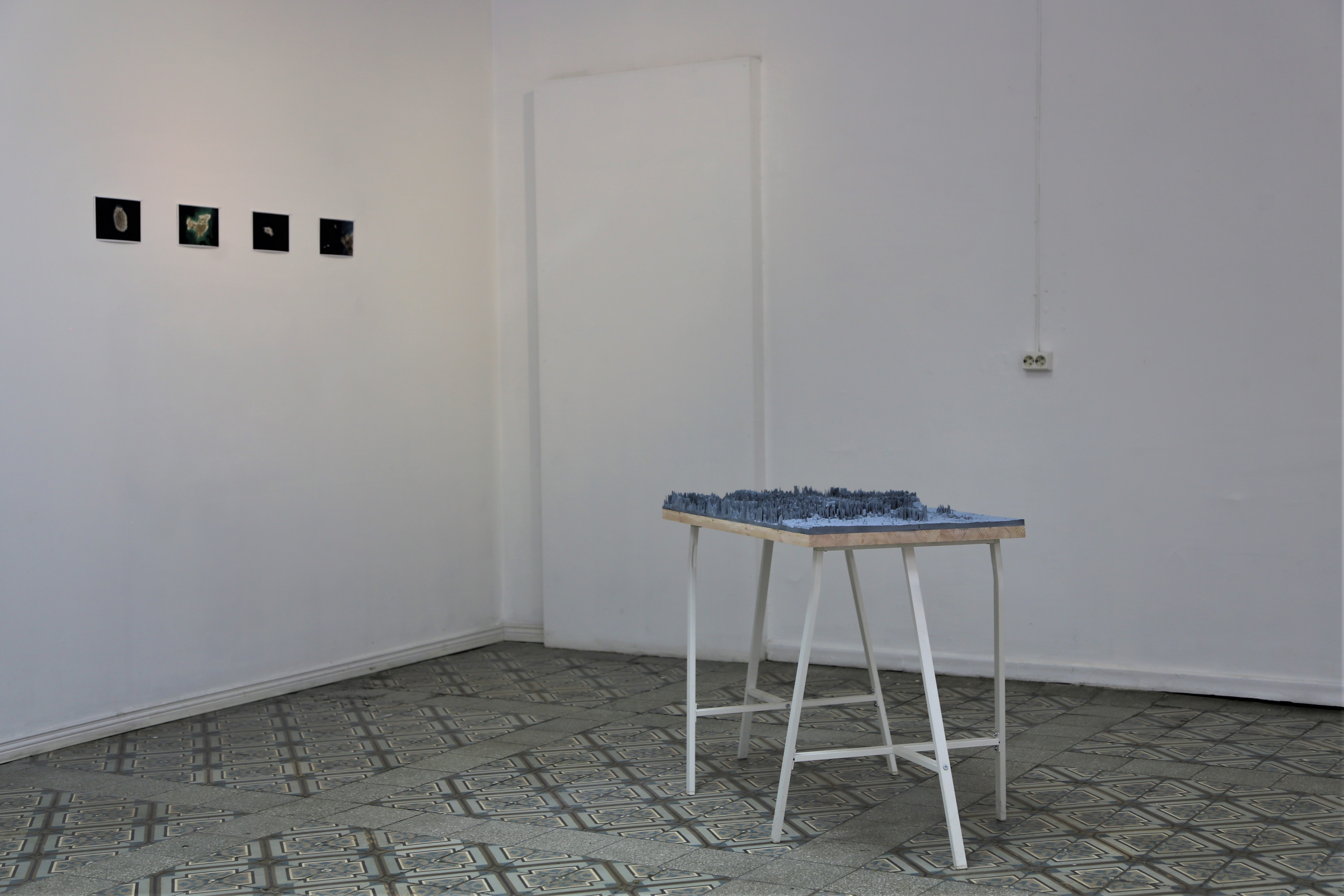
Vacation in Greece
2020,
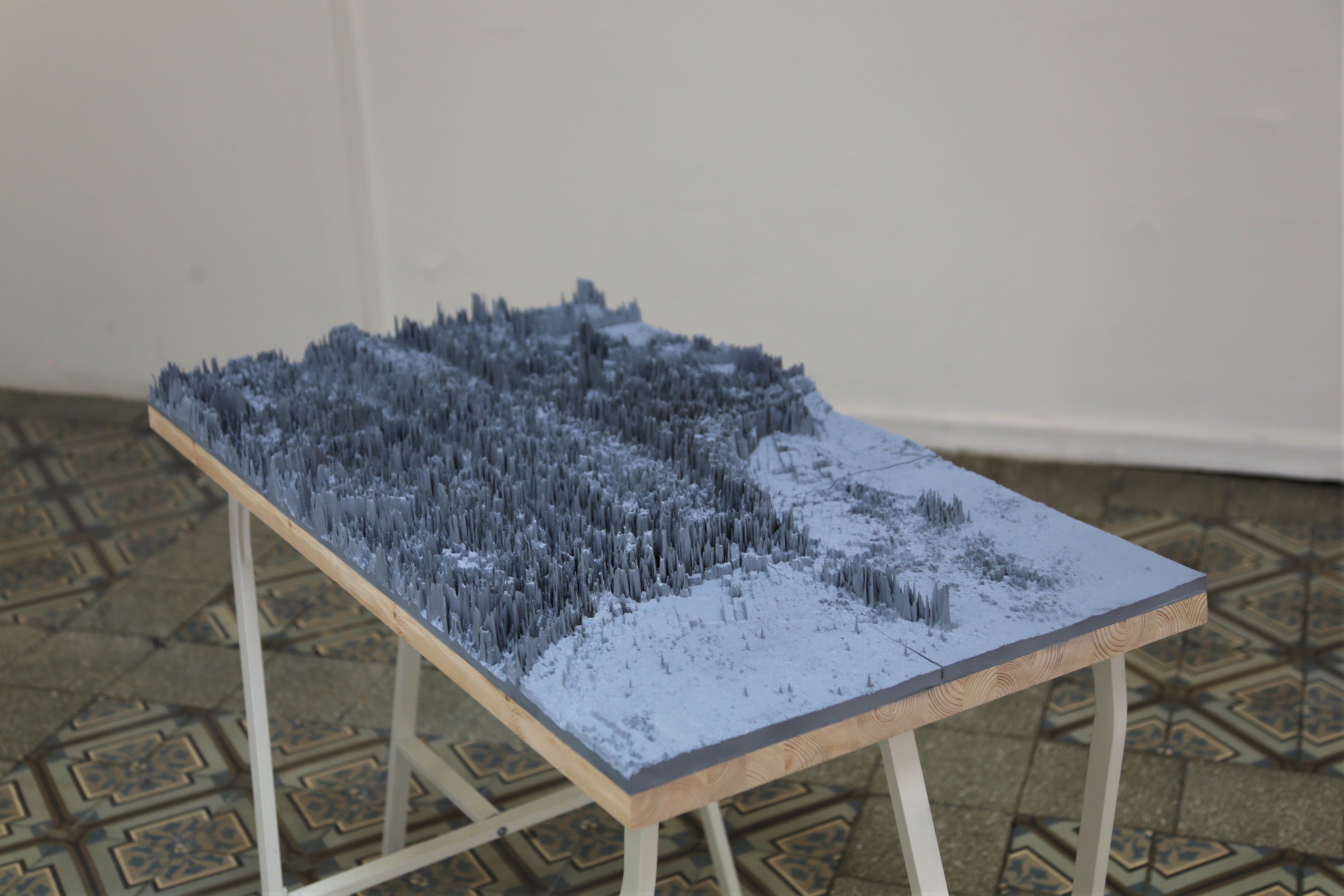
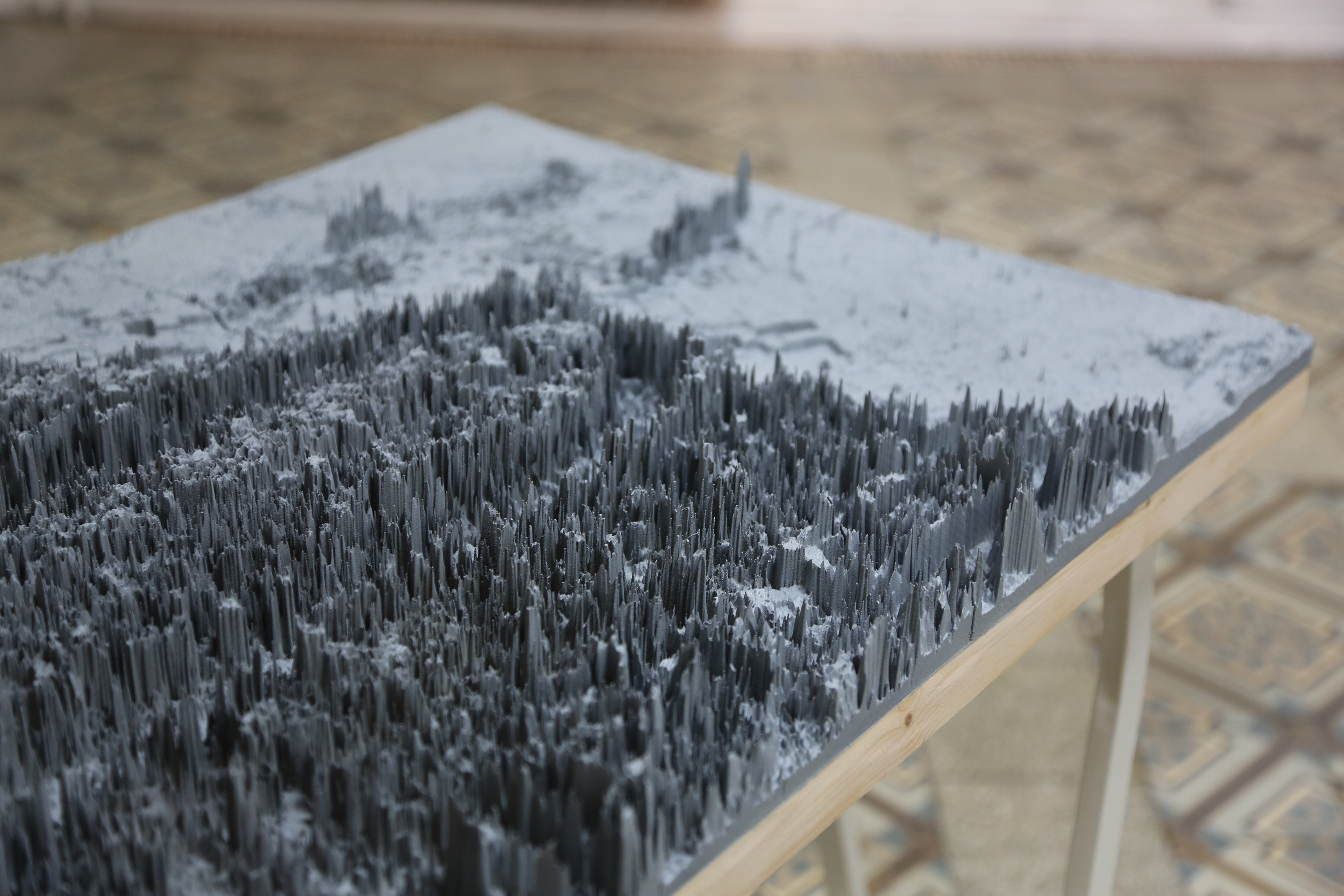
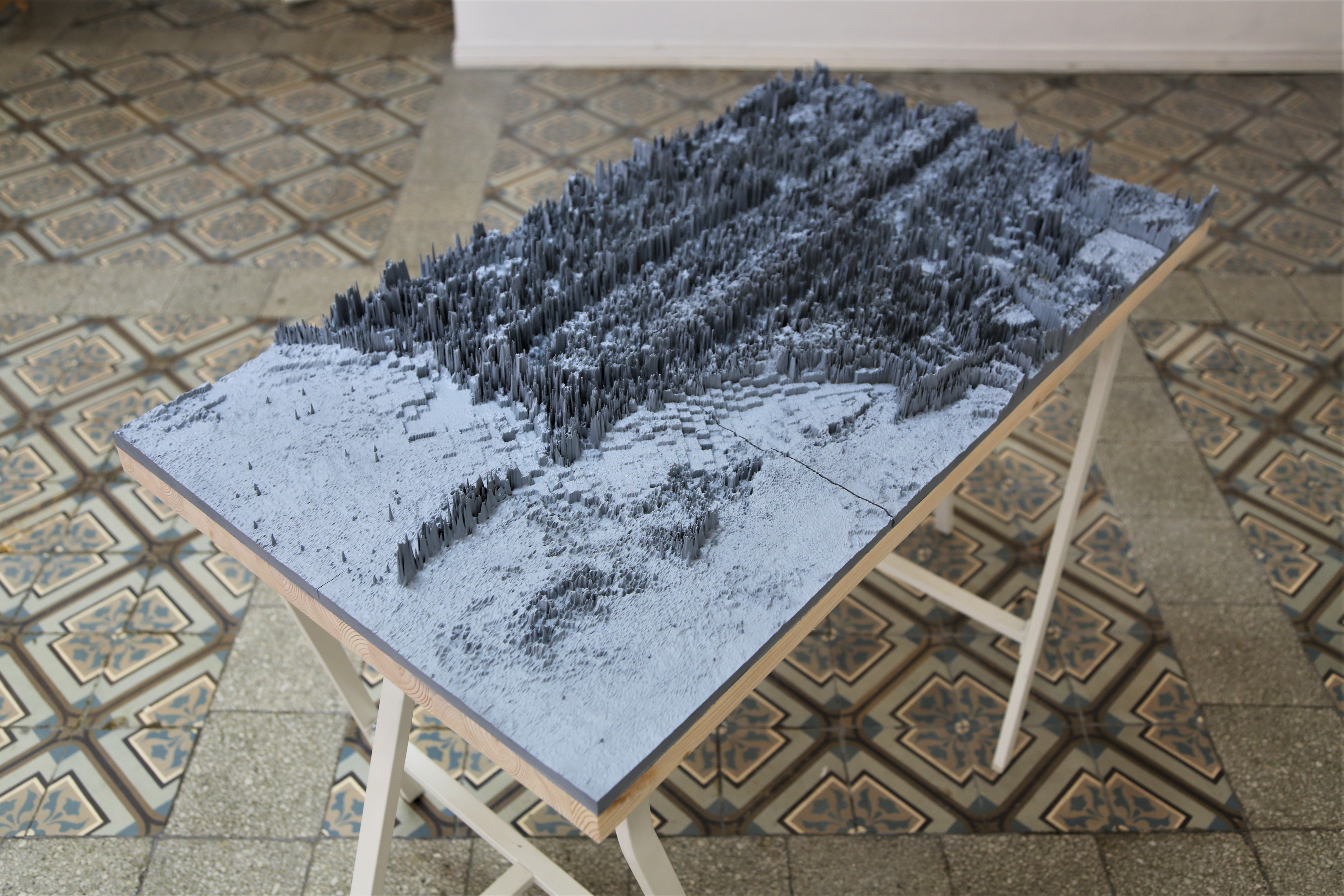
3D print, 100x54x7 cm
Digital prints, 14x21 cm each
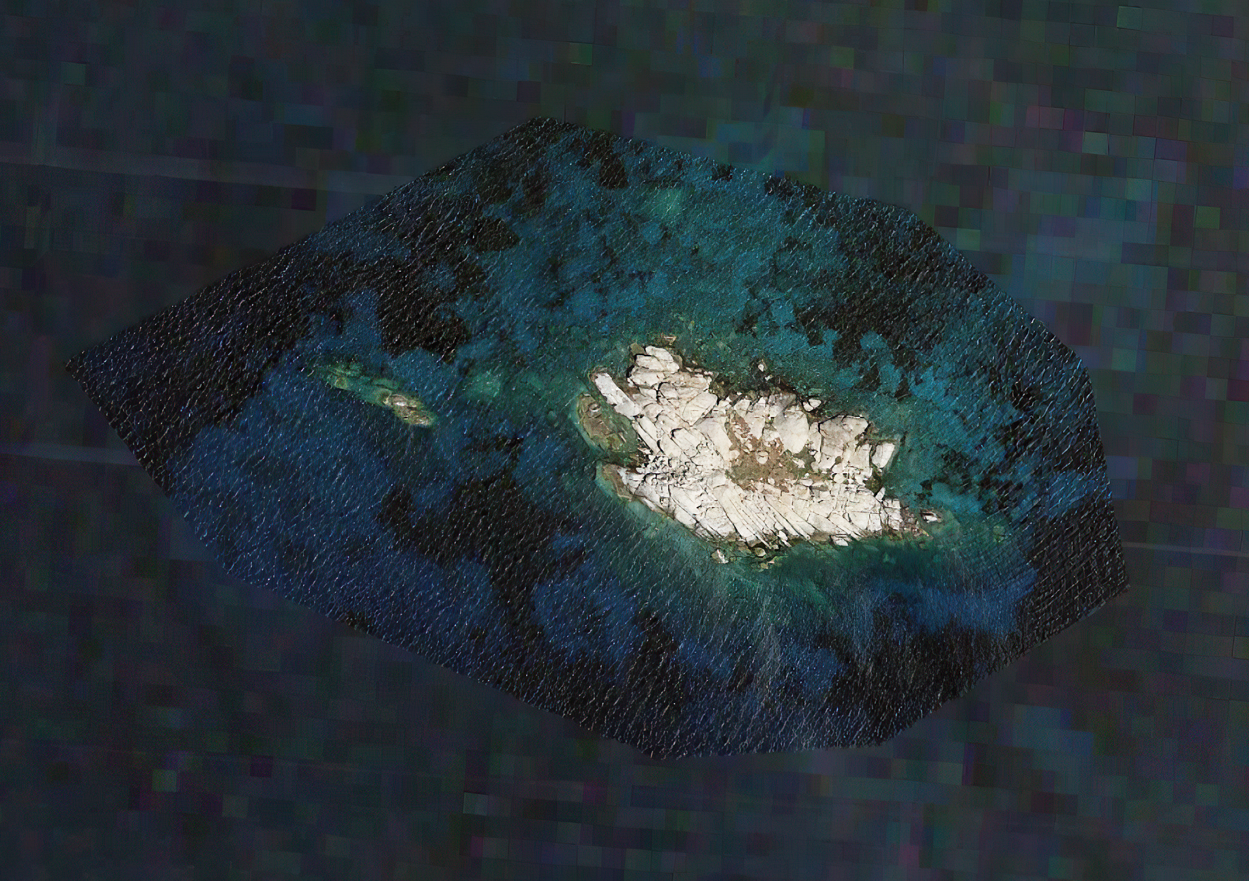
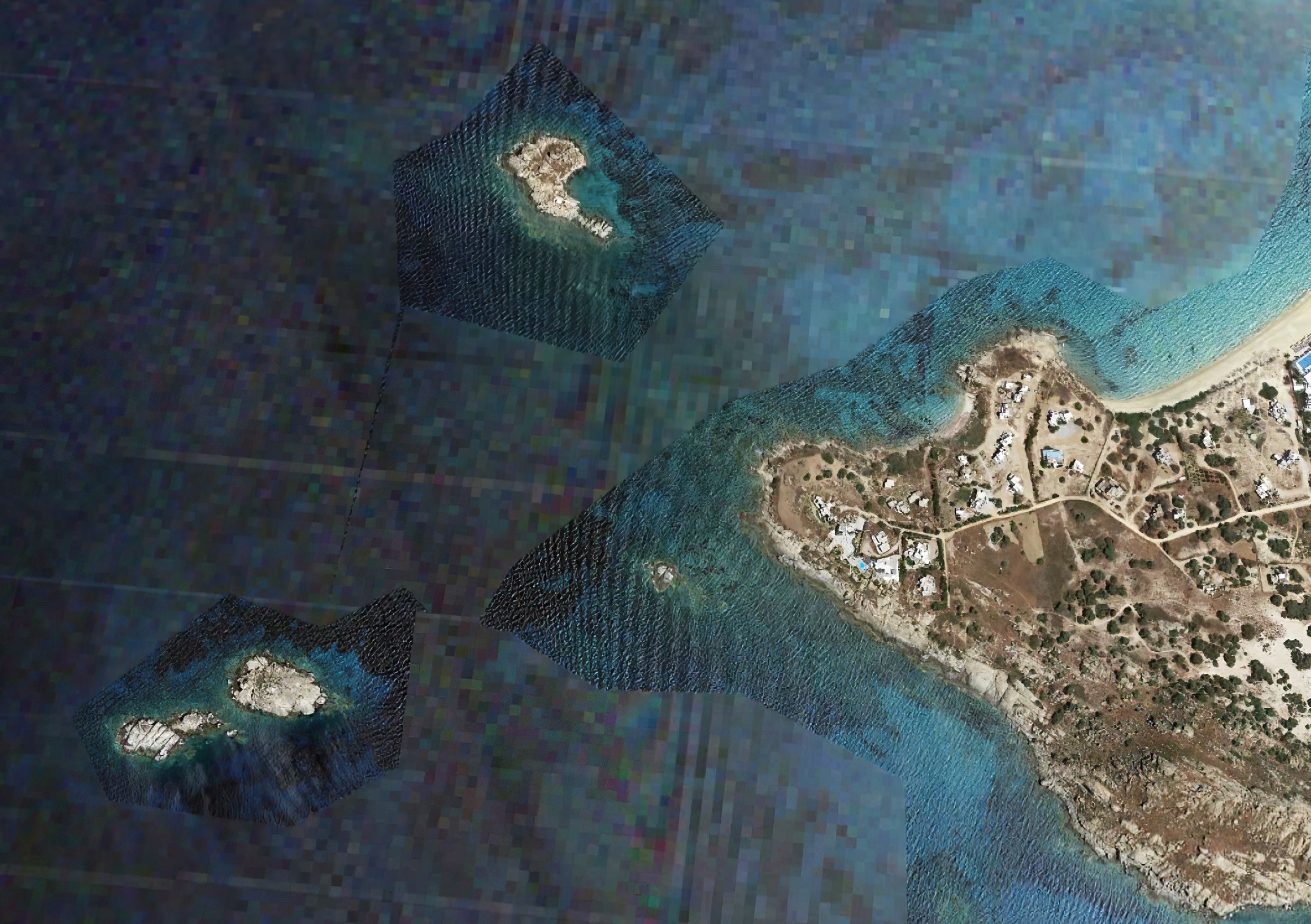
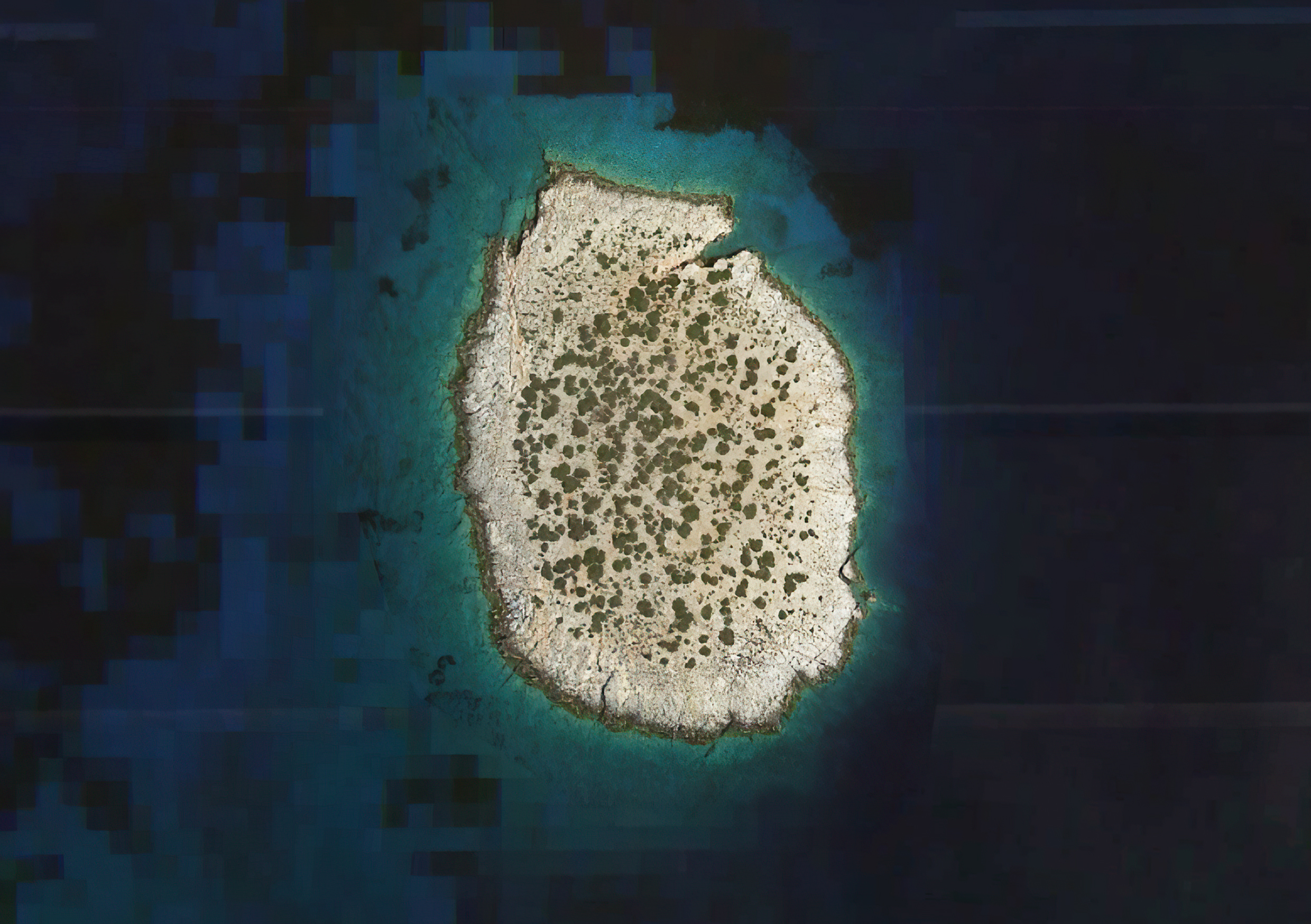
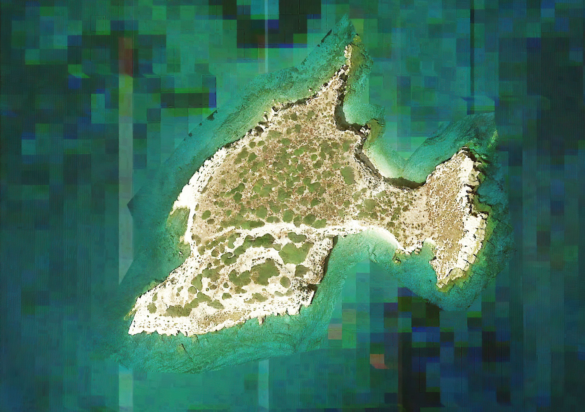
Vacation in Greece refers to cartographic censorship in the Aegean Sea with sculpture work and photos from satellite views. Greece has a huge amount of censored areas in online maps, such as military zones, refugee camps and civil airports. These are usually blurred or pixelated in two dimensions, however, Cephalonia International Airport is censored in three dimensions. The sculpture is a 3D printed model of the Cephalonia airport created via photogrammetry with 6000 satellite images.
In the photo series, the sea is pixelated around the islands in online maps. The Greek state censored the continental shelf, in particular areas in Aegean Sea, like in those photos. The reason for the censorship is a backward-looking problem between Greece and Turkey: they both lay a claim on maritime boundaries defined by the continental shelf. In 1973, Greece claimed ownership of mineral rights in the continental shelf extending from beneath all its islands in the Aegean. Turkey proposed that the continental shelf be divided through negotiations. In March 1987, a decision of the Greek government to nationalize the consortium of companies that were drilling oil off Thasos (island in Aegean dispute), and planned exploratory oil drilling 11 miles east of the island of Thasos, such as the impression by Turkey that Greece was planning new researches for oil, provoked tension between the two countries. The crisis escalated, armed forces of both countries were on alert, and both sides said they would use force if obstructed by the other. The incident nearly started a war between Greece and Turkey.[1]
[1] New York Times. March 28-29, 1987